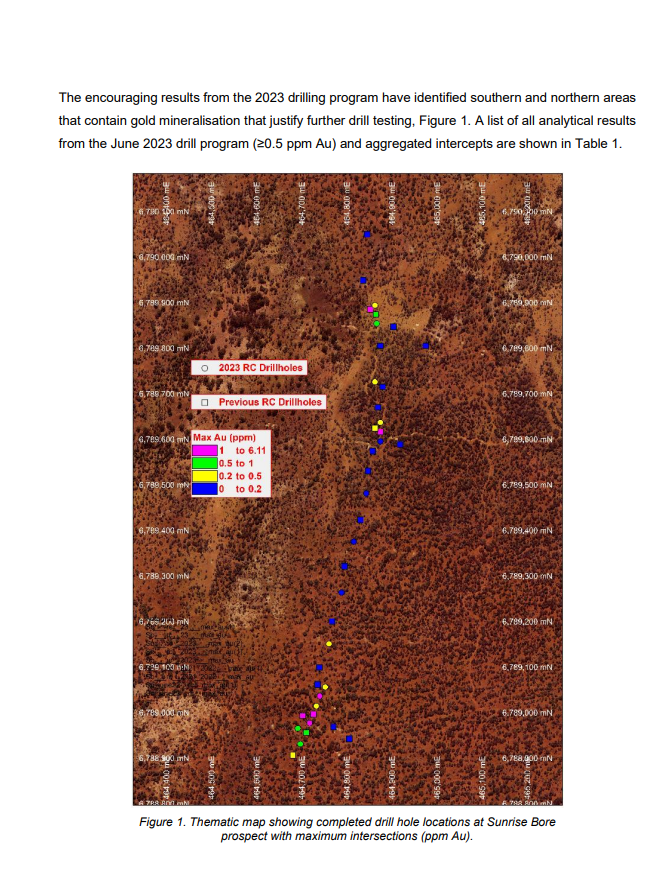
Background Sunrise Bore Project (E39/1748) The Sunrise Bore project is situated within the Mt Weld pastoral lease, approximately 220 km Northeast of Kalgoorlie. The project is located within the Menzies and Laverton Shires, about 15 km east of the Sunrise Dam gold mine,
ASX Market Announcements (weblink.com.au)


Background Sunrise Bore Project (E39/1748) The Sunrise Bore project is situated within the Mt Weld pastoral lease, approximately 220 km Northeast of Kalgoorlie. The project is located within the Menzies and Laverton Shires, about 15 km east of the Sunrise Dam gold mine, as shown in Figure 2. Geologically, the Sunrise Bore project is in the Laverton Basin in the Eastern Goldfields region, and it is predominantly underlain by lateritic duricrust and transported alluvial silts. Prospective sequences within the tenement consist of layered ultramafics interleaved with granitic intrusions as part of what appears to be a layered complex. The tenement geology comprises mafic and ultramafic flows with minor interflow sediments (mostly cherts) in the western parts of the area and a granite batholith to the east. The eastern domain comprises mainly granite with rafts of amphibolitic greenstone. The terrain in the east of the project area is variable, with good outcrop associated with breakaways and erosion and colluvial sheet wash related to broad areas of minor to no relief. To the west, mafic and ultramafic volcanic rocks are abundant and represent the easternmost part of the Merolia Greenstone Belt. A transported cover largely obscures the bedrock geology of this area. Visits to the tenement found significant residual terrain, mostly of lateritic residuum or lag-derived lateritic residuum. In other parts of the project area, sheet wash and colluvium were found on either the residual profile or a previously truncated surface
Toot, toot..


