The Murray does reach the sea, and I'm pretty sure it always has except for brief periods when the Murray mouth became blocked by sand and you could drive a 4WD across it. The Murray flows into Lake Alexandrina and then down to Goolwa and out into the ocean, although some of it also flows into the Coorong. The mouth now has a couple of permanent dredges parked there and they will dredge it if it becomes too shallow, to allow access to the sea for boats, out of the river (and the Hindmarsh Island Marina).
Here's a photo of the Murray mouth that I took from Hindmarsh Island a few months ago.
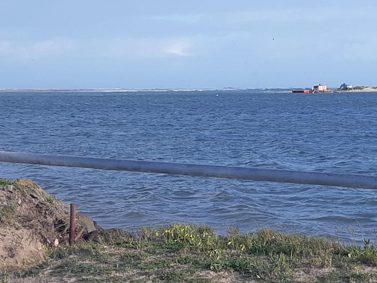
There's a dredge and a barge there on the right alongside an excavator parked on the sandhills between the River and the ocean. That whole section across from that excavator on the right to the land that is out of shot on the left was sometimes passable by 4WD years ago when the river flow was low enough - before they started regularly dredging.
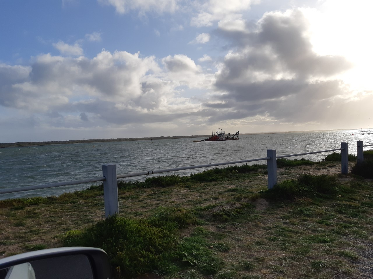
Here's the second dredge boat parked in the Murray just north of the mouth. I reckon they use this one to tow the barge and to empty it.
Some video of some info about the Goolwa Barrages (before the mouth) here: https://youtu.be/nzUsQZTs1u0?t=407
That should start at or around the 6:47 mark. Also good video about how far the River has come up around Renmark and Berri down to Barmera (all on the SA side of the Vic border) here: https://youtu.be/_Yqt8K_KuUA
They filmed that one a couple of weeks ago and posted it to YouTube on Dec 2nd. That Caravan Park (the Riverbend Caravan Park) they show at around the 6 minute mark - that is on the left bank of the River as they cross the Paringa Bridge is now flooded after the river breached the new levee. The SES issued an evacuation order for that park last week (on the 6th) before the levee was breached. They have also now closed off part of a southern part of Renmark (which is called Crescent) due to flooding.
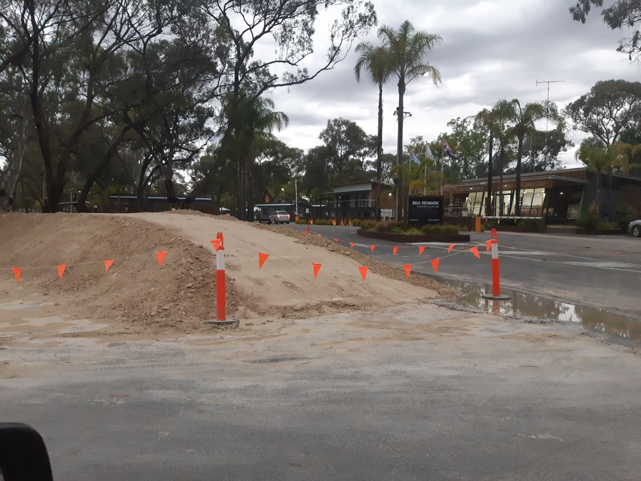
There's a second Renmark caravan park (the Renmark Big 4 Riverfront Holiday Park) just to the west of that flooded one (the Riverbend Caravan Park) and that second one (the Big 4 Holiday Park) is still open, or was when I typed this. Here's a photo I took of the entrance to that one 3 weekends ago with a new temporary levee being built in the foreground.
And here's what was left of the Boat Ramp just to the left of that photo above where they used to hire out Kayaks to tourists.
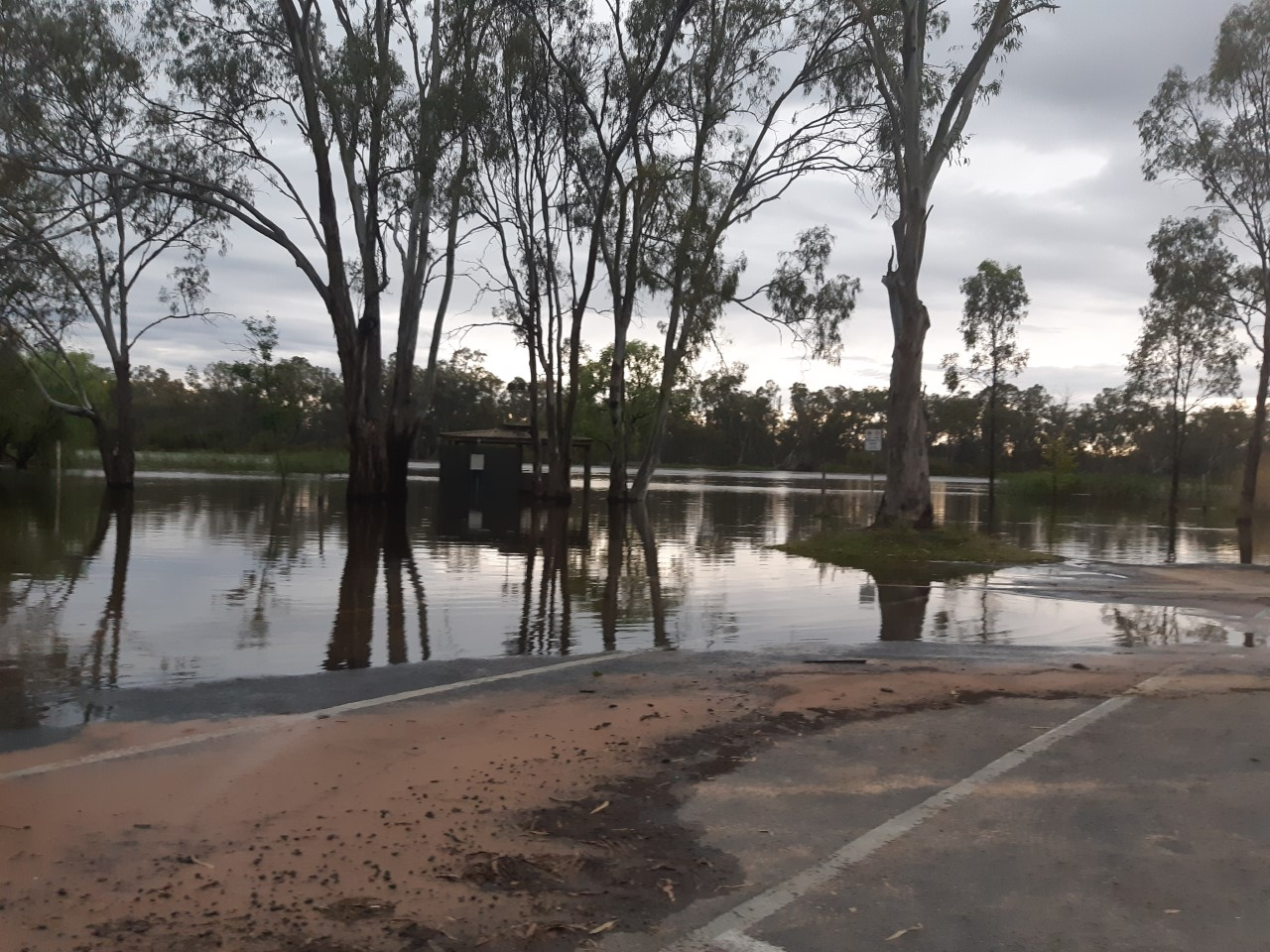
That hut used to be on the foreshore and the car park stopped just short of it. It's in the River now. And that was three weeks ago.
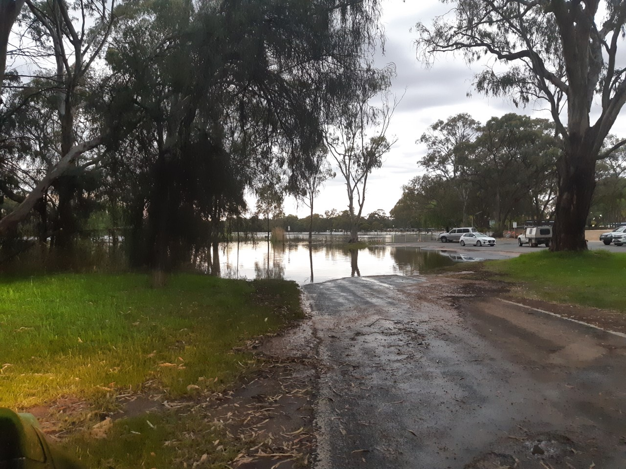
The following was the car park entrance. [remember - the water level is much higher now than when I took this snap]
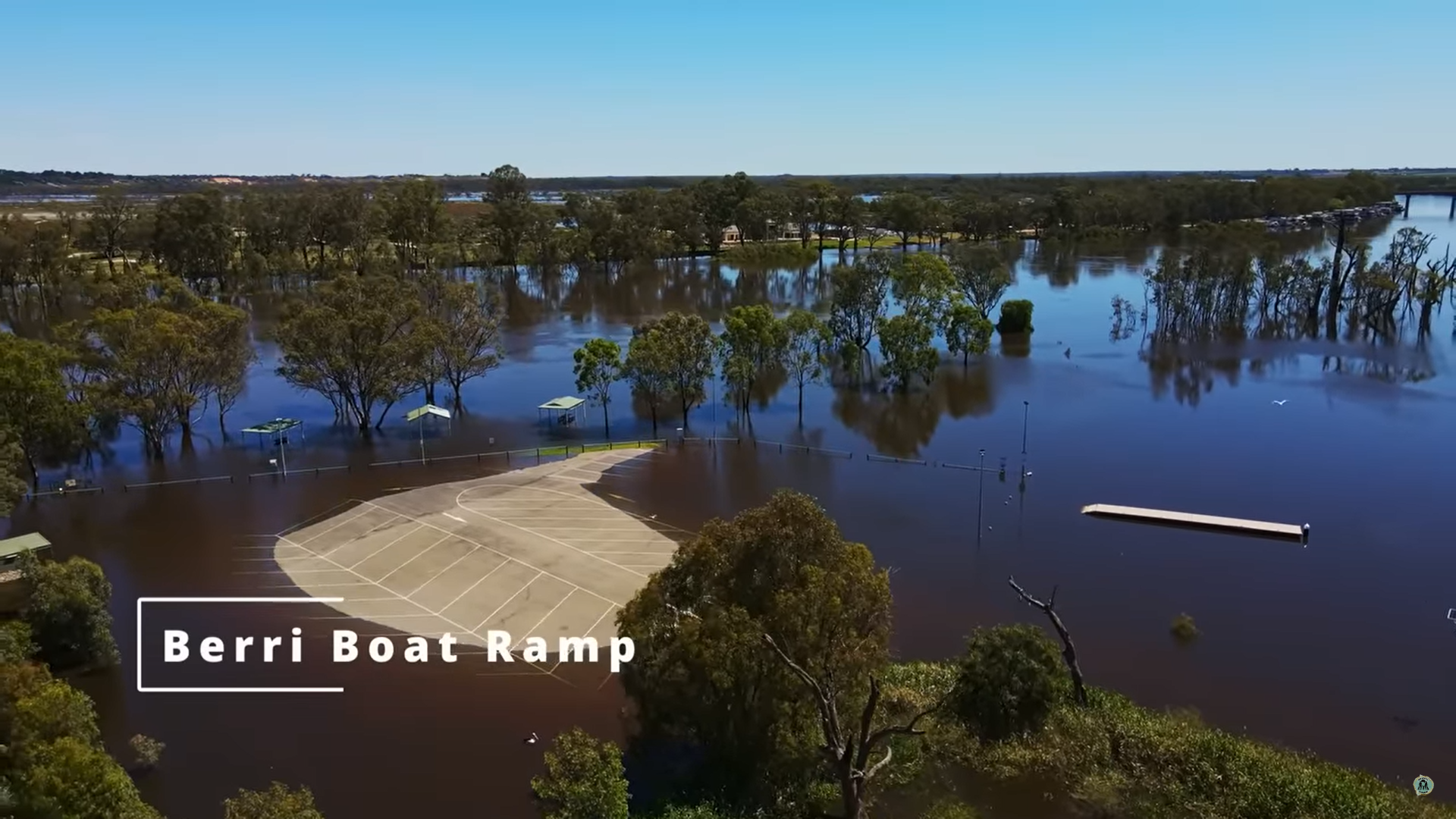
Here's how the Berri Boat Ramp looked a couple of weeks ago - and the water is more than a metre higher now.
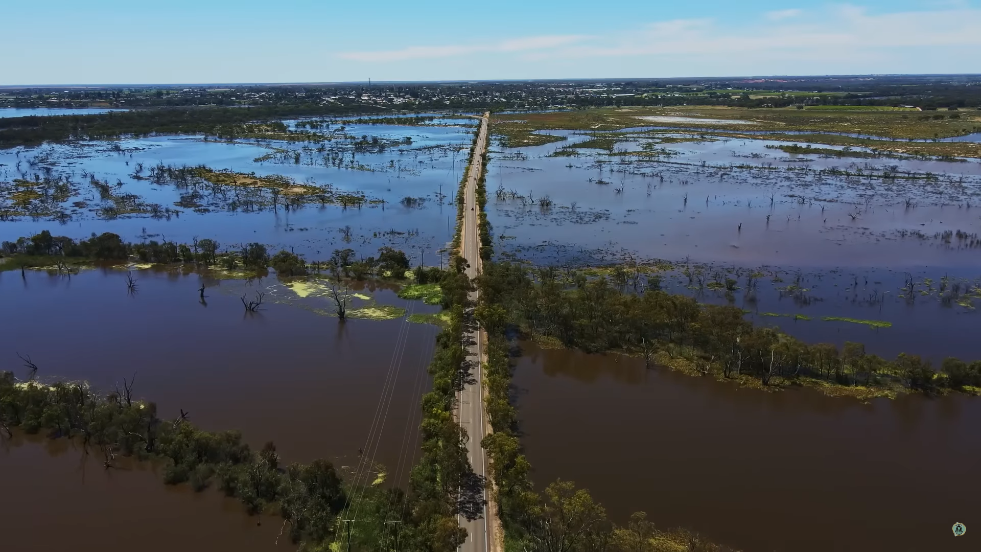
The following image is of the main road between Berri and Loxton - called the Bookpurnong Road - back at the start of December
That road is now closed. This is what it looked like about 3 days after they posted that video.
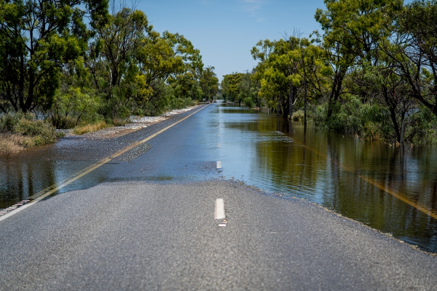
Source: https://www.abc.net.au/news/2022-12-05/sa-woman-builds-own-flood-levee-is-not-entitled-to-assistance/101732922
It's fully underwater now. That whole area is under water.
Here's another image from the "Our Whittle Adventure" video posted to YouTube on December 2nd [https://youtu.be/_Yqt8K_KuUA - I provided a link to it above also.]
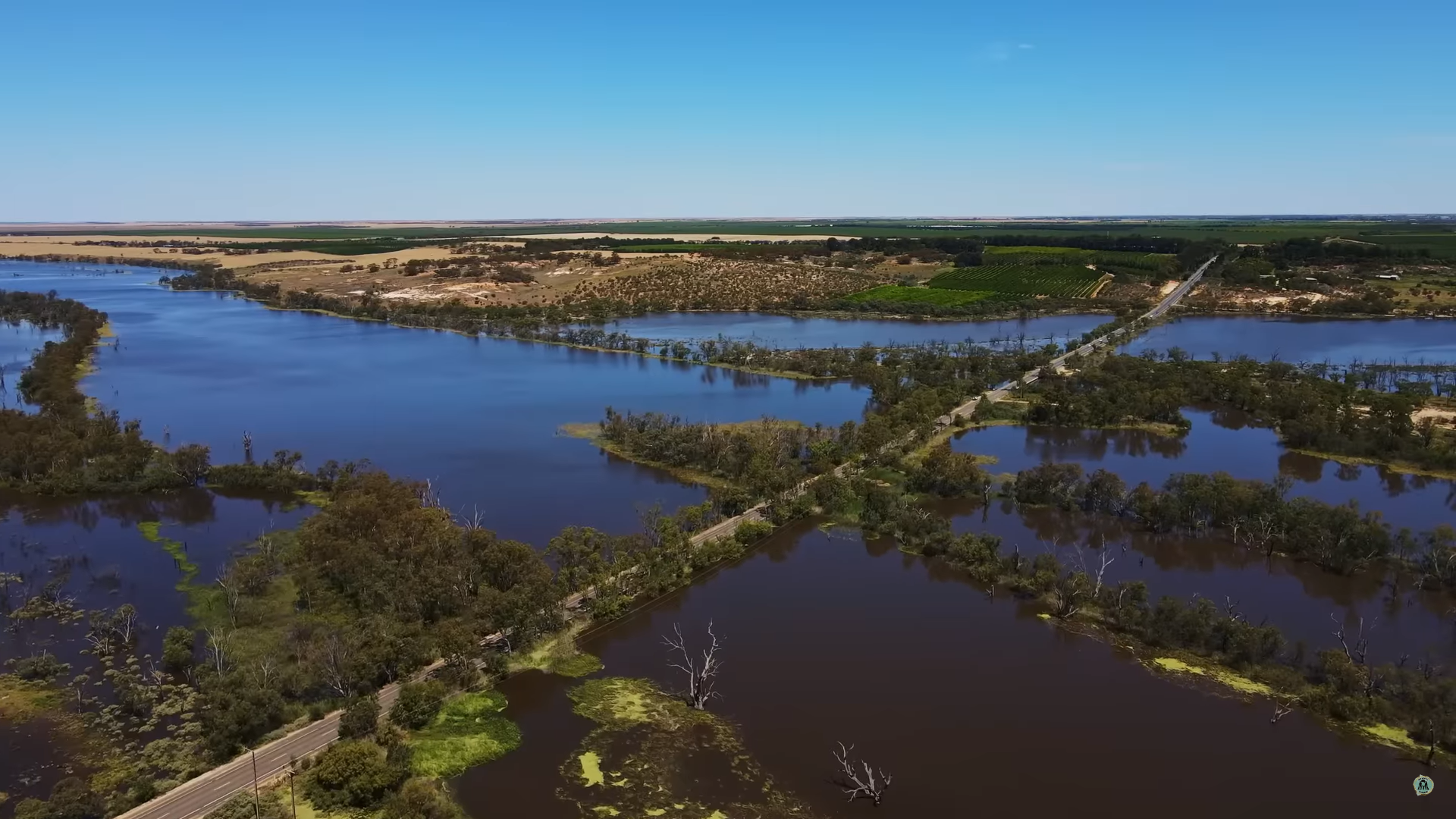
It would be interesting to see what that looks like now.
Most of the ferrys have already been closed, with the rest expected to come offline during the next week.
https://indaily.com.au/news/2022/12/09/more-road-and-ferry-closures-as-murray-floodwater-rises/ [December 9th]
Rising River Murray leads to power worries for Riverland farmers, as some Renmark aged care residents to be evacuated - ABC News [December 4th]
Daily River Murray flows crossing SA border reach levels not seen since 1970s as date for first peak pushed back - ABC News [December 1st]
Prime Minister Anthony Albanese praises Riverland's resilience ahead of predicted River Murray flood peak - ABC News [December 3rd]
The River is expected to peak in the area towards the end of December and then again in January or February due to more water being released from the Hume Dam (near Albury/Wodonga).
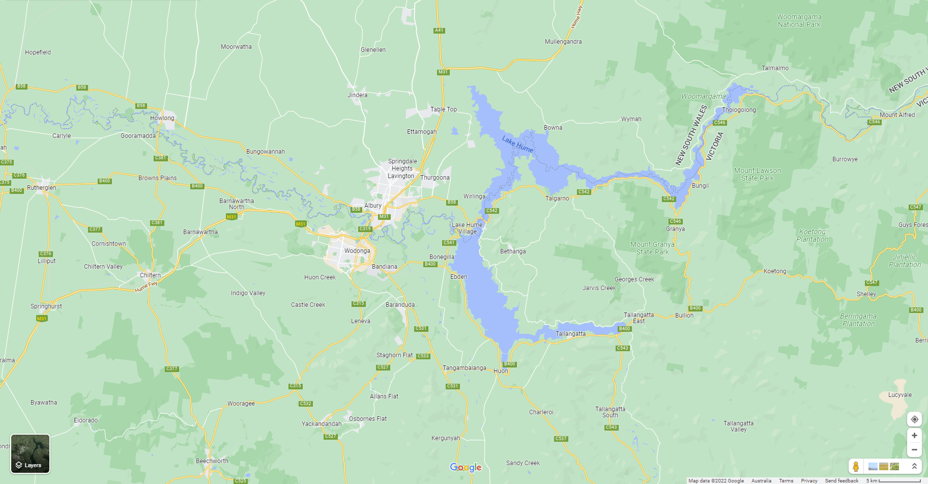
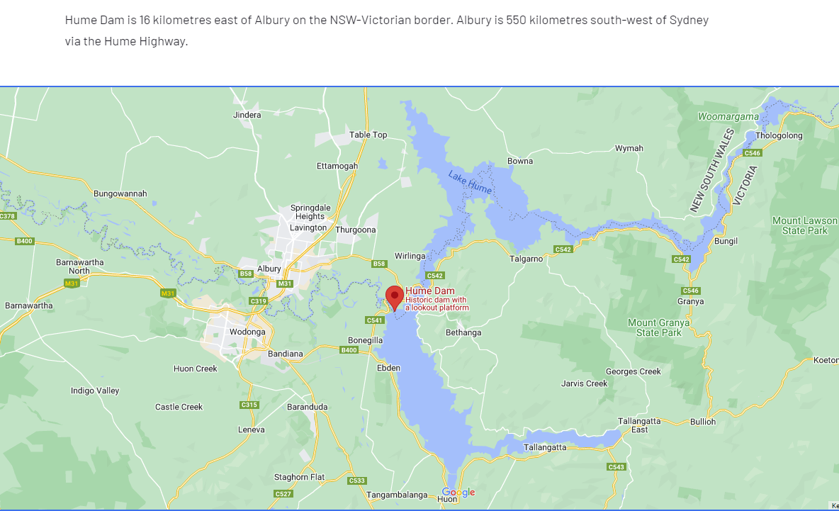
Lake Hume (shown in the first image below) and the Hume Dam (location shown in the second image below) are partly in NSW and partly in Victoria as the border runs through the middle of the river - and through the middle of the upper part of Lake Hume - which the river runs into from the east. You can usually click on these images to enlarge them and then click again to return to this post.
Flooded river communities on high alert as more water released from Hume Dam - ABC News [November 11th]
The Hume Dam water levels can be checked any time from here: Hume Dam - WaterNSW
Currently 98% full. They will need to release more water soon.
Everything that is added to the River upstream flows down to SA. It takes a few weeks to get here, but it gets here.


